The Watershed Plan & Helpful Resources
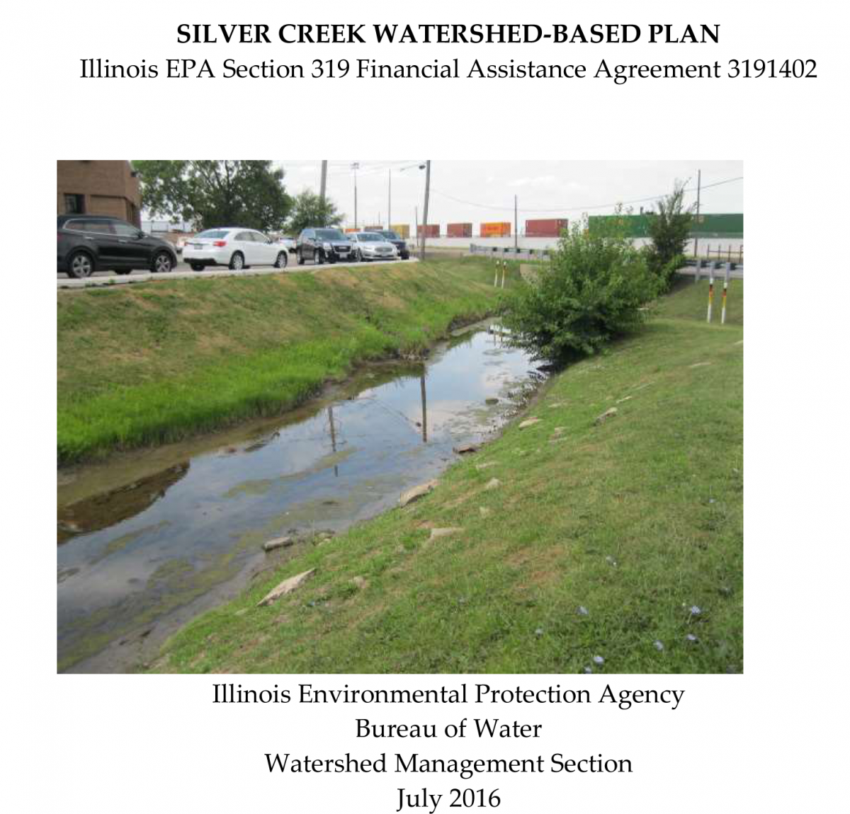
The Plan was prepared by the SILVER CREEK WATERSHED COMMITTEE & LIVING WATERS CONSULTANTS, INC. and completed in July 2016.
The report was prepared using United States Environmental Protection Agency funds under Section 319 of the Clean Water Act distributed through the Illinois Environmental Protection Agency.
The findings and recommendations contained in the plan are not necessarily those of the funding agencies.
The report was prepared using United States Environmental Protection Agency funds under Section 319 of the Clean Water Act distributed through the Illinois Environmental Protection Agency.
The findings and recommendations contained in the plan are not necessarily those of the funding agencies.
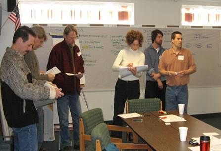
Silver Creek Steering Committee
Coordinator:
Ted Gray, Living Waters Consultants
Members:
Mike Beranek, Village of Bensenville
Jimmy Caporusso, Leyden Township
Bruce Garelli, Village of Wood Dale
Nalini Johnson, Village of Maywood
Ed Stoelinga, Village of Melrose Park
Joe Thomas, Village Engineer, Village of Franklin Park
Mark Weber, Village Engineer, Village of Franklin Park
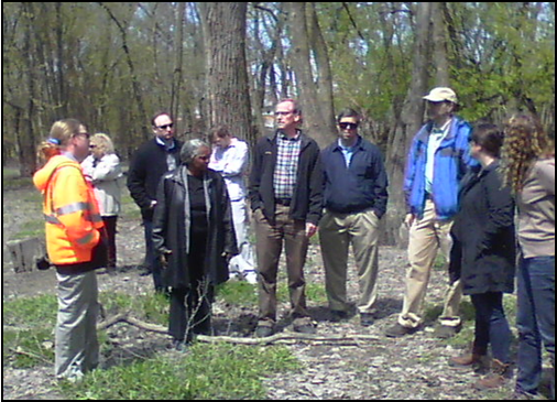
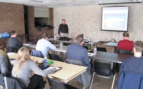
Stakeholder tour of the watershed during planning process.
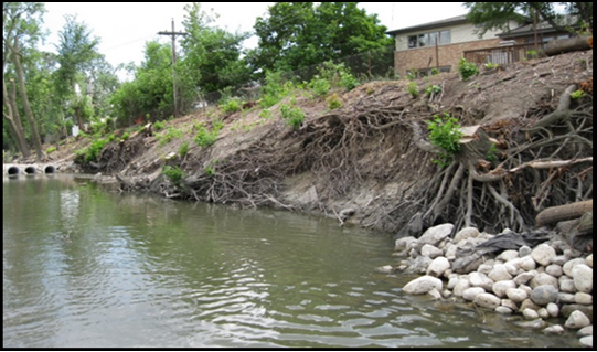
Erosion found along bank of Silver Creek.
Links to communities in the Silver Creek Watershed
Bensenville
Franklin Park
Leyden Township
Maywood
Melrose Park
Northlake
Wood Dale
also Chicago (O’Hare Airport)
Bensenville
Franklin Park
Leyden Township
Maywood
Melrose Park
Northlake
Wood Dale
also Chicago (O’Hare Airport)
Other Links:
County Websites:
Cook County
DuPage County
Forest Preserve Websites:
Forest Preserve District of Cook County
Forest Preserve District of DuPage County
County Websites:
Cook County
DuPage County
Forest Preserve Websites:
Forest Preserve District of Cook County
Forest Preserve District of DuPage County
Continuing the work of the plan
Ongoing efforts are being made toward the implementation of this Plan. Please contact us to determine how you can help to protect and improve Silver Creek for our communities.
Visit our New & Updates Page to find out more and how to get involved.
Visit our New & Updates Page to find out more and how to get involved.
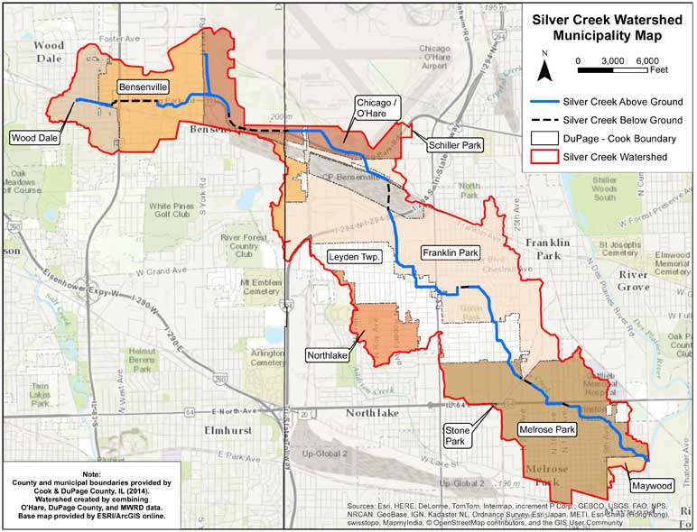
Maps of the Watershed
Frequently Asked Questions about watersheds & The Plan
What is a Watershed?
A watershed is a basin-like landform defined by highpoints and ridgelines that descend into lower elevations and stream valleys. A watershed carries water "shed" from the land after rain falls and snow melts. The Silver Creek Watershed, as shown HERE, encompasses over 10.6 square miles of land in Cook and DuPage Counties in Illinois.
Any precipitation that falls into the area bounded in red will generally flow downhill to towards Silver Creek, and eventually towards the Des Plaines River While some of this precipitation will evaporate before reaching a stream, or infiltrate into the ground, the majority of the runoff from precipitation is flowing through the creeks of the Silver Watershed.
For more information, visit:
EPA Website USEPA Resources USGS Website
What is a Watershed Plan?
A watershed plan is a comprehensive study of all the and sources of pollution on the land that drains rain and snow melt to a specific stream. The plan identifies information about the levels of pollution in the stream, the potential sources of the pollution and the amounts each source contributes. Also included are steps that can be taken to reduce the levels of pollution and flooding and who can take action to perform these steps. Everyone who lives or works in the watershed should participate in developing and implementing this plan so that all concerns about the water in the stream are discussed, investigated, and addressed to ensure clean water for everyone to use.
Click Here to download and read the Silver Creek Watershed Plan
What is Point Source vs. Non-Point Source water pollution?
Point Source water pollution comes from a readily identifiable source, such as a pipe discharging its contents into a stream, river or lake.
Non-Point Source (NPS) water pollution is so named because the pollutants do not originate at single point sources, such as industrial or municipal waste discharge pipes. Instead, NPS pollutants such as fertilizer, road salt, sediment, pesticides, nutrients and bacteria are carried over fields, lawns, and streets by rainwater or snowmelt. These pollutants then enter lakes and streams or seep into groundwater. While some NPS pollution is naturally occurring, most of it is a result of human activities.
Water Education Foundation - Point Source vs Non-point Source Pollution
Implementation of the Silver Creek Watershed-Based Plan
What is a "Best Management Practice" or BMP?
Best Management Practices (BMPs) are effective, practical, structural or nonstructural methods which prevent or reduce the movement of sediment, nutrients, pesticides and other pollutants from the land to surface or ground water, or which otherwise protect water quality from potential adverse effects of human activities. Although it is unrealistic to expect that all non-point source pollution can be eliminated, BMP’s can be used to minimize the impact of human activities on water quality. These BMP’s must be reasonable, achievable and cost effective.
The 2016 Silver Creek Watershed Plan identified a “Best Management Practice” on my property. What next?
If you have viewed the “Recommendations Map” for your subwatershed, and a specific water quality “Best Management Practice” (BMP) was identified for your property, the choice is yours as participation is entirely VOLUNTARY. If you wish to explore further what would be involved in implementing a recommended BMP on your property, feel free to complete the form found HERE. The 2016 Silver Creek Watershed Plan did NOT identify a “Best Management Practice” on my property, but I may need one. What next?
If you have viewed the “Recommendations Map” for your subwatershed, and a specific water quality “Best Management Practice” (BMP) was NOT identified for your property, it is recognized that there may still be a water quality issue occurring that may need to be addressed. Again, the choice is yours as participation is entirely VOLUNTARY.
If you wish to explore further what would be involved in determining what could be done to address this issue, or to possibly have a specific BMP recommended for your property and added to the current NCWP Update, feel free to contact us at
info@silvercreekwatershed.org
What Types of Best Management Practices Are Potentially Eligible for USEPA Section 319 Funding?
Any project that will result in a demonstrable reduction in Non-Point Source pollutants, such as soil (sediment), nutrients, or manure / septic system leachate, to streams, wetlands, or lakes may be eligible.
Practices could include:
• stream channel, streambank, or shoreline stabilization
• creation of vegetated buffer strips along streams, lakes, and drainageways
• restoration of wetlands
• creation of water quality features such as bioswales or rain gardens
Examples of BMPs that may be funded through Section 319(h) are summarized below and in the Illinois’ Nonpoint Source Management Program (INSMP). The list is not all-inclusive, and inclusion of a BMP here or in the INPSMP does not equate to an automatic eligibility for funding under Section 319(h) CWA.
Streams
- Stream channel and streambank stabilization
- Meandering a channelized stream
- In-stream habitat restoration
- Reconnecting stream to floodplain
- Levee removal or modification
Wetlands
- Wetland restoration or enhancement
- Wetland area protection
- New wetland development
Lakes
- Lakeshore stabilization
- In-lake practices
- Detention practices (sediment and nutrient)
- Aerationdestratification
Urban
- Buffers and filter strips
- Rain gardens and rain barrels
- Permeable and porous pavement
- Green roofs
- Bioswales, bioretention, and urban filter strips
- Soil erosion and sediment control
Riparian Zone
- Native vegetation planting
- Tree and shrub planting
- Riparian wetland restoration
Links to information on funding:
Illinois’ Nonpoint Source Management Program
Illinois EPA NPS Grants
USEPA Section 319(h) CWA Funding Guidelines
